Ten fold more accurate satellite navigation to 10 cm
Every day, satellites provide important data for climate and environmental research, such as how high sea levels are rising or what effects global warming is having on glacier retreats in the Alps. The more precise the satellite data, the more accurate the scientists’ predictions. To achieve this, RUAG Space is working on a study for the European Union to determine the position of satellites more precisely, which in turn will enable better satellite data on climate change, for example.
RUAG Space recently conducted its first tests on Earth. This involved testing new software with an existing navigation receiver for RUAG Space satellites under simulated space conditions. “The result was impressive,” reported Heinz Reichinger, Technical lead engineer for navigation receivers and signal processing. “We were able to determine the satellite’s position ten times more accurately than previously possible.” Position accuracy improved from about 100 centimeters to 10 centimeters. “This is a quantum leap in high-precision positioning of satellites” With an accuracy of 10 centimeters, the test results even significantly exceeded the original expectations of accuracy of 20 centimeters.
The higher accuracy was achieved with a new software program. In addition to conventional signals, the software can also process an additional position signal from the European Global Navigation Satellite System, Galileo. To determine the exact position of satellites, RUAG Space’s latest navigation receivers combine signals from both Galileo and the American GPS system. “We are using the Galileo signal to position satellites that are in space. But there is currently untapped potential in the Galileo satellites as they transmit signals in several frequency bands,” explained Martin Auer, who is leading the study at RUAG Space. With the Galileo High Accuracy Service (HAS), Galileo will pioneer a worldwide, free high-accuracy positioning service aimed at applications that require higher performance such as drones or autonomous vehicles. This service should be available in 2022.
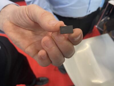
“A software update can be loaded on navigation receivers already in space as well as receivers we’ve already delivered to customers and are still on Earth.” The hardware of the devices remains unchanged. ESA, for example, is already having the RUAG Space navigation receiver “PODRIX” delivered to it for the Sentinel-1C environmental satellite upgraded with this new software for in-orbit validation of the satellite. The Sentinel-1C satellite built by Thales Alenia Space will be launched in 2022.
However, navigation receivers from RUAG Space that process Galileo signals already ensure precise positioning. These include the one for the Sentinel-6 Copernicus Satellite, which has been in space since November 2020. It measures the extent of sea-level change and provides important data on coastal areas at risk from sea-level rise. “The more accurately the satellite’s position can be determined, the more precise the environmental data it collects and provides. This potentially unlocks new observations and predictions essential to cope with the effects of climate crisis, for example in exposed coastal cities such as Venice,” explained Fiammetta Diani, Head of Market Development at the European Union Agency for the Space Programme (EUSPA).
More accurate data about a satellite’s position also helps prevent satellites from colliding in space, thus providing better space situational awareness (SSA). When satellites collide in orbit, a lot of satellite debris is created. Due to the high speed in orbit, even the smallest debris particles pose a huge threat to other satellites. “The more precise the position of a satellite is known, the better a potential accident can be predicted and, for example, evasive manoeuvres can be carried out. Our more accurate satellite positioning data helps to avoid space debris,” emphasized Heinz Reichinger of RUAG Space.
In the coming years, the launch of many satellite swarms of hundreds to thousands of small satellites in low-Earth orbit is planned. For such swarms of identical satellites, RUAG Space is developing a low-cost navigation receiver that is lighter and smaller than conventional devices and already includes the new software capable of processing the additional Galileo HAS signals as a standard feature. The new receivers called “NavRix PinPoint” are more cost-effective due to the use of standardized electronic components (Commercial Off the Shelf).
At the beginning of 2021, the European Union Agency for the Space Programme (EUSPA) awarded a research contract worth one million euros to RUAG Space. The aim of the study is to increase the positioning accuracy of satellites. The study will be completed in 2022.
Study: www.ruag.com/en/newspaper
 If you enjoyed this article, you will like the following ones: don't miss them by subscribing to :